Severe storms possible in Central Florida. Here’s when

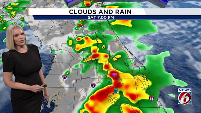
ORLANDO, Fla. – We’ve designated today as a Weather Alert Day due to the risk of strong to severe storms this afternoon and evening across east Central Florida. Make sure you stay weather-aware, especially if you have outdoor plans.
What to expect this weekend:
It’s Mother’s Day weekend, and if you’re planning brunch outdoors or a beach trip, the best weather will be earlier in the day on both Saturday and Sunday.
Storms are likely to pop up by mid to late afternoon each day, so it’s a good idea to wrap up any outdoor plans by early afternoon to stay ahead of the weather.
The Storm Prediction Center has placed our area under a Level 1 (Marginal Risk) for severe weather today and again tomorrow, meaning isolated strong to severe storms are possible. Our biggest threats are gusty winds up to 60 mph, quarter-sized hail, heavy rain, and frequent lightning.
Storms today will begin first across our southern counties and move to the northeast through the late afternoon and early evening.
Most of the storms will wind down by midnight.
Looking ahead:
-
Sunday through Tuesday: We’ll see more of the same pattern with scattered storms each afternoon, particularly over inland areas. Rain and storm chances spike Monday and Tuesday as a cold front pushes through. This will bring a heightened risk of localized flooding, especially north of I-4 where rainfall totals could reach 3 to 5 inches. Monday is shaping up to be the wettest day, with widespread showers and storms expected.
-
Mid to late week: The weather settles down midweek as high pressure builds in. Sunshine returns, but so does the heat! By late week and into next weekend, highs will climb into the lower to mid 90s with heat indices pushing into the triple digits — our hottest stretch of the year so far.
Copyright 2025 by WKMG ClickOrlando – All rights reserved.

