30,000 evacuated in Palisades Fire as high winds batter Southern California
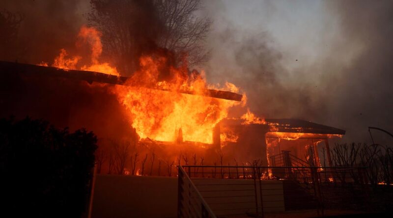
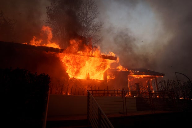
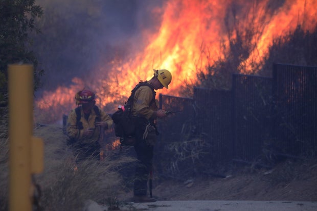
Tens of people fled their homes as a brush fire in the Pacific Palisades quickly spread to nearly 3,000 acres Tuesday, a blaze that authorities said could grow further as even stronger winds are expected through the night.
Click here for an evacuation map.
The Los Angeles Fire Department said the Palisades Fire started at 10:30 a.m. near 1190 North Piedra Morada Dr. With winds reaching at least 40 mph, the flames quickly spread to about 200 acres and grew exponentially.
It continued to spread rapidly through the hillsides. As of 6:30 p.m., the fire had burned 2,921 acres. Authorities evacuated about 30,000 people as flames threatened more than 10,000 homes.
Santa Ana winds are expected to strengthen later in the evening, peaking from 10 p.m. Tuesday through 5 a.m. Wednesday — potentially complicating firefighting efforts and carrying flames even further.
“We’re not out of the woods by any stretch of the imagination,” Gov. Gavin Newsom told reporters Tuesday afternoon, saying that the state dispatched 110 fire engines to Southern California in anticipation of the high winds.
Newsom said he saw homes burning but authorities have not yet released an exact estimate for the damage.
Eric Thayer / Getty Images
Forecasters say gusts could reach up to 100 miles per hour in some parts of the region — likely the worst conditions seen since a windstorm in 2011 left behind $40 million in damage in Los Angeles County.
The Pacific Coast Highway was completely shut down near Topanga Canyon Boulevard, according to the California Department of Transportation.
Emergency shelters and evacuation map
With the flames moving quickly, some drivers abandoned their cars on Sunset near where the main LA roadway meets the PCH. Some said firefighters told them to get out and flee on foot. About 30 vehicles were left abandoned, according to the LA Fire Department.
Meanwhile, thousands of residents escaped their homes as firefighters continued battling the Pacific Palisades blaze.
Krishan Chaudry, a resident in the LA coastal community, said he could see flames burning from his backyard, which he said appeared suddenly. Thick, billowing plumes of black smoke were seen rising over the PCH as flames tore through hillsides.
“This happened just spur of the moment,” Chaudry said. “We were just looking at the smoke, and then all of a sudden, we saw fire everywhere.”
The Westwood Recreation Center has opened as an evacuation center and overnight shelter for evacuees and small animals, according to fire authorities.
DAVID SWANSON/AFP via Getty Images
The latest information from Cal Fire on evacuations and resources for those affected can be found here.
Roads close, schools relocate due to growing blaze
The following closures of the PCH have been announced by authorities while the latest updates can be found here.
- Southbound Pacific Coast Highway at Las Flores Canyon Rd
- Southbound Pacific Coast Highway at Topanga Canyon Boulevard
- Coastline Drive and Southbound Pacific Coast Highway
Several schools in the Pacific Palisades area are temporarily relocating students and staff, according to a Los Angeles Unified School District spokesperson.
The campuses affected include Palisades Elementary School and Marquez Elementary School, which are relocating to Brentwood Elementary Science Magnet, while Paul Revere Middle School is being relocated to University High School Charter. Meanwhile, Corpus Christi School is evacuating as the brush fire continues to spread.
Flames also appeared to spread to Palisades Charter High School.
“Life-threatening” windstorm and a major red flag warning
Many parts of Los Angeles and Ventura counties, including the area where the wildfire started, are facing a “Particularly Dangerous Situation” red flag warning this week. It’s a relatively rare advisory the National Weather Service issues in more extreme cases, and it’s the same warning that was issued just before the Mountain Fire tore through nearly 20,000 acres in neighboring Ventura County last year.
Forecasters have warned of a “life-threatening” windstorm that is likely the most powerful one to hit the region since 2011, which left behind millions of dollars in damage and led to 400,000 people losing power.
This week, Cal Fire has been preparing additional resources as much of the region braces for particularly strong Santa Ana winds, which can fuel and swiftly spread powerful wildfires. Gusts could up to around 60 to 70 mph in many areas and up to 100 mph in a few parts of Southern California, according to forecasters.
“This will likely be a life-threatening, destructive, and widespread windstorm,” the National Weather Service said Monday, noting that the “Particularly Dangerous Situation” warning will be in effect from noon Tuesday through 4 p.m. Wednesday for areas of LA including Malibu.
In December, the coastal community faced the Franklin Fire, which destroyed more than two dozen structures, including a number of homes, as it burned through over 4,000 acres.
Check back for updates on this developing story.


